We see what we want to see
Making patterns when there is no such meaning
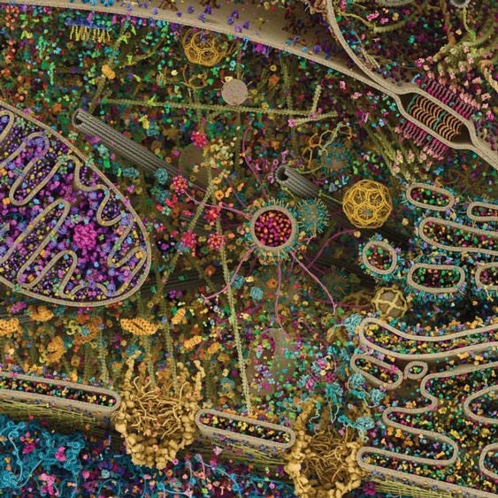
Quick. What do you see in the above picture? Height perhaps? Things to climb on? Depth to fall from? Eclectic-colored trees? Claws at the bottom? Roots? Those are all things that I see as my brain wants to interpret it, based on the knowledge of the patterns that I have been trained to recognize.
I saw an amazing picture today. This 3D rendering of a eukaryotic cellular life is modeled using data from X-ray, nuclear magnetic resonance, and cryo-electron microscopy. This photo is part of a series that appears in the "Images from Science 3" open-to-public exhibition visiting Johns Hopkins Jan. 20 - March 20.
What do you see in this picture? I will space my answers way below so that I don’t bias your interpretation.
.
.
.
.
.
.
.
.
.
.
.
.
I see an aerial map from the sky. Highways, Roads, suburbs, town centers, malls, schools, houses, parks, etc., etc. Now again that my brain’s interpretation. Would I have interpreted differently if I have never seen satellite imagery or Google maps imagery in my life? Maybe, perhaps! But, that is what I have been conditioned to see, so I see it.
So what did you see? What did you interpret? And, why do you think that is?


